North Yorkshire County Council


Flooding has been a long-standing problem for North Yorkshire County Council and local residents. A particular stretch of the main road between the villages of Bainbridge and Wensley has often been affected by flooding due its close proximity to the River Ure. Indeed, in November 2020, as the UK felt the force of Hurricane Zeta, the area had one month’s rainfall in a single 24-hour period, leading to nine people having to be rescued by local emergency services.
Soon after, the Council launched its Safer Roads Fund initiative, aiming to reduce the number of incidents caused by flooded roads by providing clearer information on rising water levels in a more timely manner. The council turned to SWARCO UK & Ireland, whose head office is in nearby Richmond, to provide the solution.
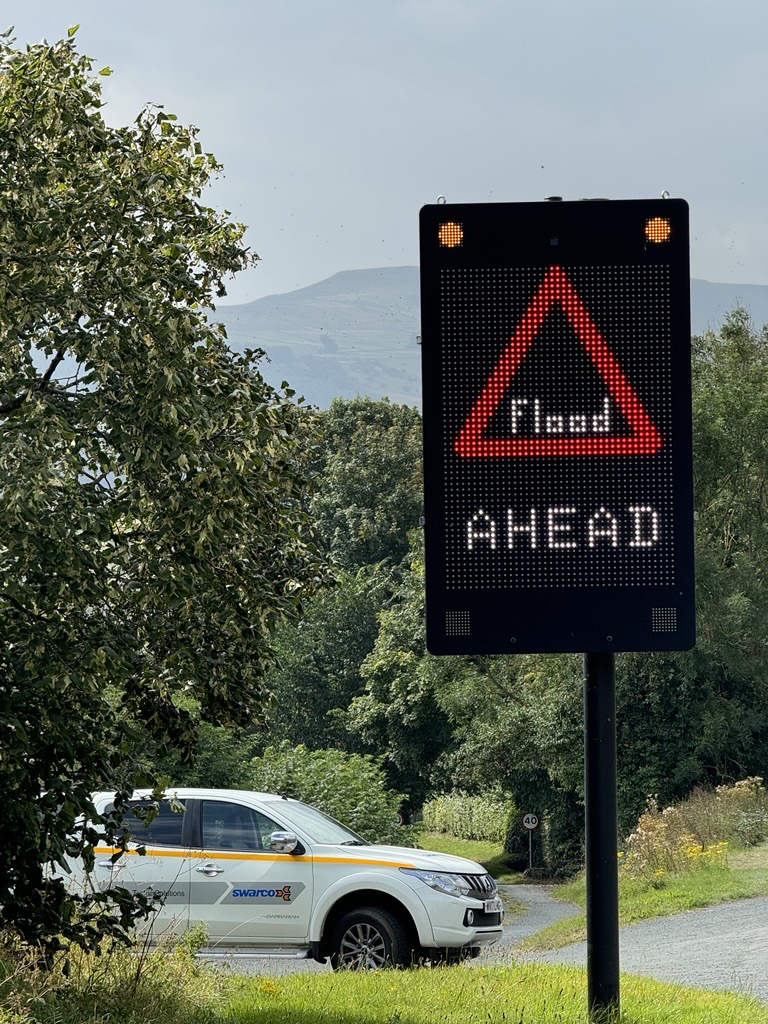
SWARCO took a holistic approach, delivering a solution that encompasses both hardware and management software, installing an intelligent flood warning system comprising five flood detection sensors, that detect when surface water levels rise, and seven full colour matrix Variable Messaging Signs (VMS) that indicate flooding and road closures as they occur in real time.
A flexible solution
The sensors are housed in subterranean chambers to measure the rise and fall of the water levels. Each sensor features a transducer which converts water into a 20mA analogue output. Using a UTMC car park count interface, the water levels are converted into a simple ‘car park’ count. With no water pressure, the detection reports ‘Spaces’. The next threshold, where water levels are rising, the detection reports ‘Nearly Full’, and ‘Full’ when flooding occurs.
The sensors are connected to a nearby control and communications cabinet which is installed at height to avoid any flood damage to components, which are battery powered with fuel cells to maintain the correct operating voltage. Each fuel cell has sufficient power to operate for up to two years. Through intelligent remote monitoring, alarms are generated should power run low between annual maintenance visits.
Providing further flexibility, the VMS have a full matrix area which enables future setting of messages to be edited, which means they can be used to negotiate changes in the weather other than rainfall, such as snow or high winds. They can also be used more generally to warn drivers of traffic or any road closures.
A faster response
The SWARCO system quickly proved its worth. Heavy rainfall in the area in the early hours of 31 December activated the system. At 02:44 AM, rising water levels caused one of the sensors to reach the ‘Nearly Full’ threshold triggering its associated sign to display a ‘Flood Level Rising’ alert message. An hour later, the ‘Full’ threshold had been reached, with the messaging switching to display ‘Flooded – Road Closed’ to clearly notify drivers, with road maintenance staff immediately notified. By 10:42 AM, water levels had receded to a safe, low level and the VMS messaging was updated to ‘Receding Flood Level’ and the affected section of the main road was reopened. In the space of just a few hours, the system showed how it can help to provide clear warning and guidance to drivers and keep them safe.
“The new system has been a huge benefit, not just to the local traveling community, but also to the business and tourism that we have in the area,” says Jayne Charlton, Area Manager at North Yorkshire Council – Highways Division. “We have a history of working very well with SWARCO and it's always been a really positive experience, with the development of solutions that work.”