Optimér luftkvalitet
Hvordan du forbedrer luftkvaliteten i din by.
Dårlig luftkvalitet påvirker os alle, inklusiv fodgængere, cyklister og bilister. Det påvirker vores helbred, miljøet og det påvirker også økonomien. Der er gennem de seneste år, ikke kun opstået et fokus på en bedre forståelse for luftkvaliteten i vores byer – men også at implementere strategier der kan forbedre situationen. Da transport er en stor årsag til luftforurening, er det vigtigt at vi ændrer den måde vi styrer trafikken på, for at forbedre luftkvaliteten.

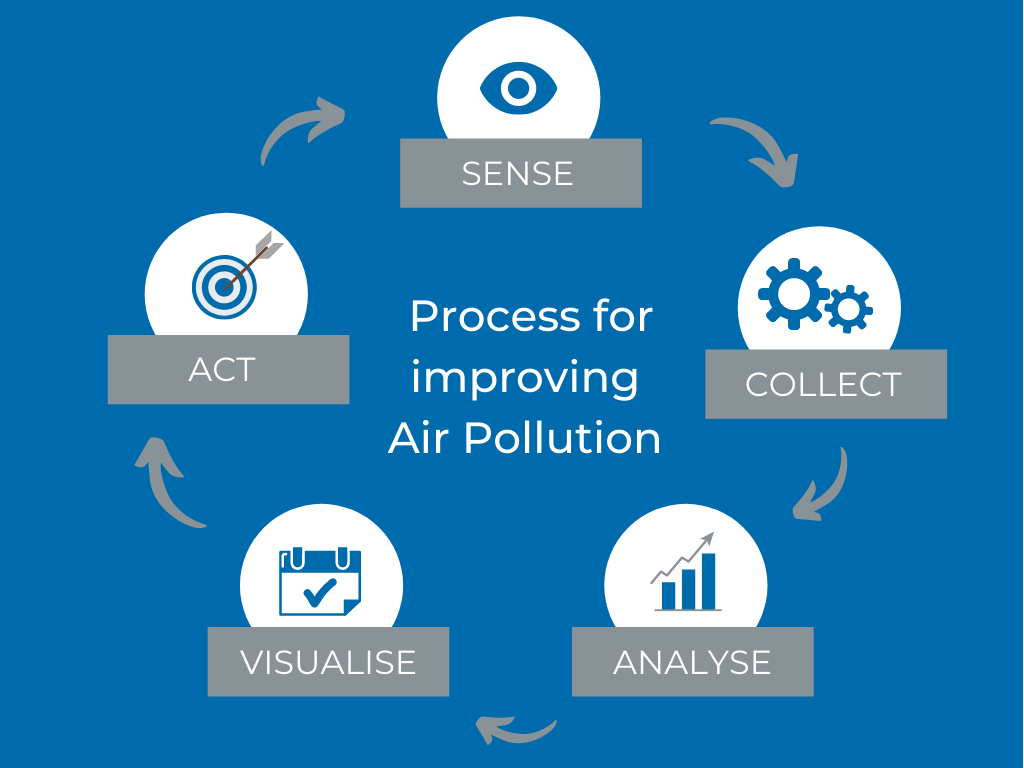
Indsaml, Analysér, Visualisér, Reagér

Luftforurening kan føre til 6 til 9 millioner for tidlige dødsfald årligt frem til 2060, og koste mellem 1-5% af det globale BNP ifølge OECD-rapporter. Samme rapporter konstaterer at transportsektoren er hovedårsagen, med en andel på omkring 50% af alle dødsfald relateret til luftforurening i Europa og USA.
At kunne forstå årsagerne til luftforurening, er det første skridt mod at håndtere problemet. Først da kan du analysere, planlægge og implementere strategier der kan forbedre luftkvaliteten, og dermed også opnå både helbreds- og miljømæssige fordele.
SWARCO's løsninger
Som kan forbedre luftkvaliteten
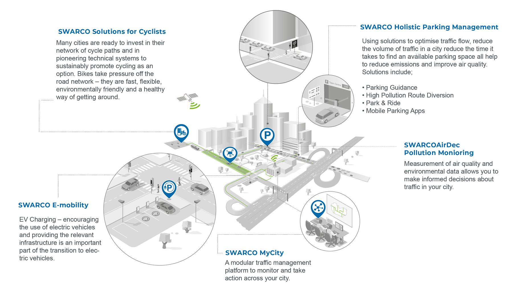
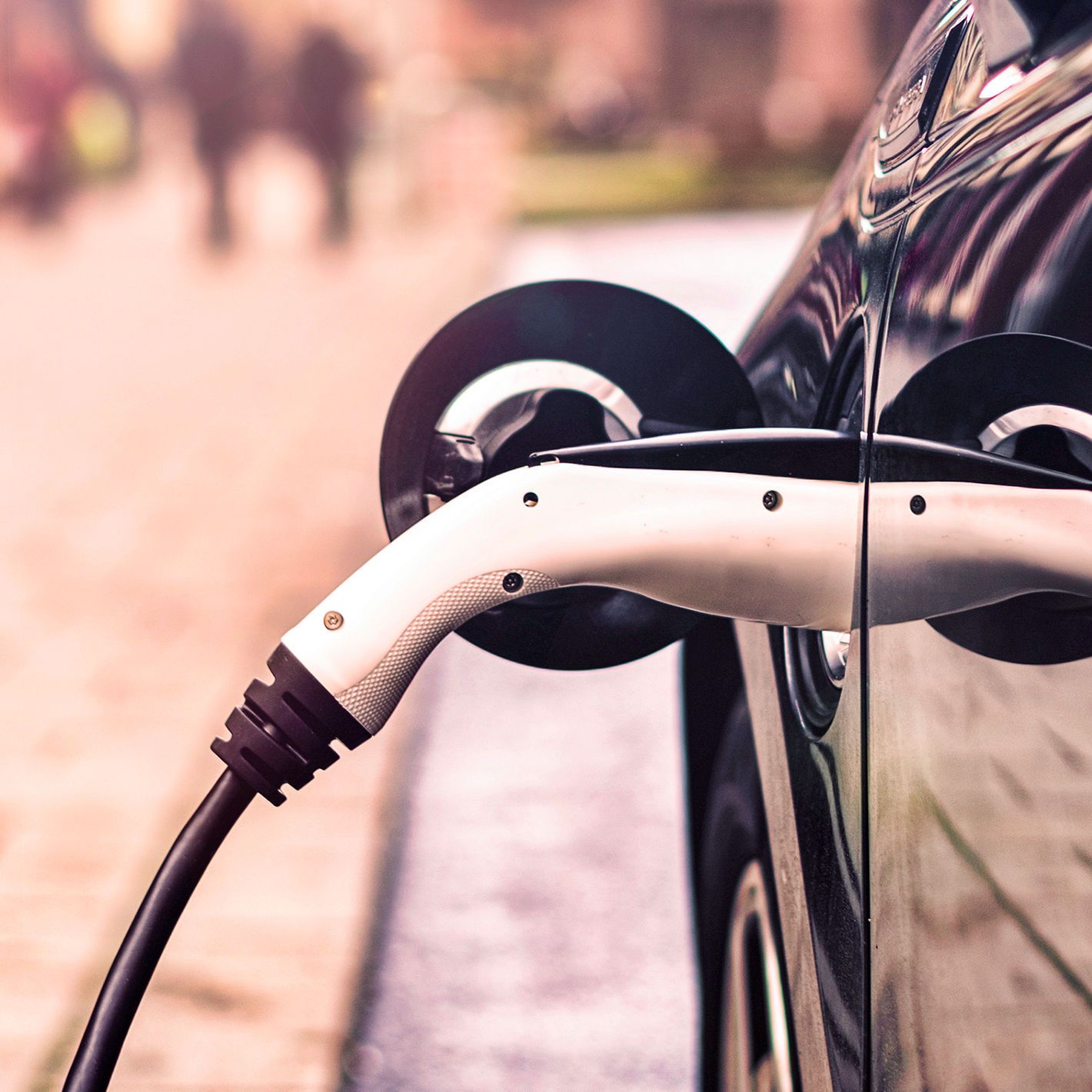
EV Charging
One of the main barriers in the uptake of electric vehicles is the available infrastructure to charge them. Providing the appropriate infrastructure for Electric Vehicles will create trust with the public, the introduction of clean air zones in heavily polluted city centres are coming into action and the 2030 deadline set by many European governments to ban the sale of new petrol and diesel vehicles is approaching.
The increased use of Electric Vehicles will also have an impact on air pollution caused by idling vehicles during congestion and at bottlenecks like intersections. Making the roads safer for other road users such as cyclists and pedestrians.

Holistic Parking Guidance
Reducing congestion in the most efficient way can make a huge impact to the volume of air pollution in our cities. By providing solutions that reduce the volume of traffic, drive times or idling traffic we can reduce the pollution in our cities.
Parking Guidance
Offering live parking guidance to drivers including parking space availability and guidance to the location of the nearest available space, this also has the added benefit of making the experience better for drivers.
Inform of alternative Routes or Transport Modes
We can support and promote the use of alternative modes of transport such as park & ride locations where the public can leave their vehicles outside the city and use public transport whilst navigating the city centre.
Alternatively, in heavily congested areas we can use Variable Message Signs (VMS) to inform all road users of information about alternative routes to take to prevent dangerous levels of poluution build-up.
Use of Parking Apps - such as PARCO-App
The free-of-charge PARCO-App for Android and iOS devices uses the same data to provide the city and its people with a "Find and Navigate" function to take motorists to the nearest free parking space, guided by their smartphone.
MyCity
The ability to represent and report on real-time validated data complements not only conventional TMS data but can be analysed alongside other integrated services such as Vehicle Counting and Classification, Driving Behaviour and Risk Scoring, and Micro-Mobility and Pedestrian data. This continuous view of multiple data streams provides a detailed view of the air quality readings, along with the potential factors behind high reported rates, and the impact on all road network users.
C-ITS/ CCAM Solutions
Cooperative Intelligent Transport Systems (C-ITS) connect vehicles to other vehicles, roadside infrastructure, road users – such as pedestrians and cyclists – and cloud-based services. Integrating a variety of ITS sub-systems with Connected and Automated Vehicles (CAV) promises to significantly improve mobility, reduce congestion, and save lives by reducing traffic incidents.
CAV trials in Europe and the United States showcase how the integration of real-time traffic signal timing is a critical part of countless connected applications. One effect of this is that travel times were seen to be reduced by up to 66%, vastly reducing the time that vehicles have to release particulates.
As this area of technology develops, more direct integration between vehicles will continue to reduce journey times and potentially the number of vehicles on the road through the potential for shared riding services.
Bicycle Solutions
Improving the air quality in Wolverhampton, England
The city of Wolverhampton, England approached SWARCO to discuss their concerns around heavily congested routes, and how this could affect air quality within the city.
MyCity was identified as a possible solution to the city’s issues. They needed a solution that would provide flexible traffic management, was easy to use and provided detailed analysis and reporting tools. MyCity allows the on-street infrastructure to be managed from one easy to use platform. The platform, which is modular allows you to add on the functionality and integrations you need to work with your city or authority.
In Wolverhampton, Variable Message Signs (VMS) were installed to offer drivers parking guidance allowing them to make informed decisions on how to locate the nearest available parking space. Air pollution monitors were also installed across the city, alongside CCTV and traffic monitoring equipment. All of the equipment was integrated into MyCity so that data could be easily analysed and reported on and importantly, action could be taken to alter the traffic management strategies of the city. Helping to prevent a build-up of air pollution and particulates in areas of heavy congestion.

John Charles, Team Leader Road Safety & Sustainable Travel at Wolverhampton City Council, says MyCity provides a raft of information that is affording great control of the city’s traffic systems:
“With pollution monitoring that notifies us when NO2 reaches a certain level, vehicle counting for 19 different classifications – including motorbikes, public buses and taxis – a live map view of the congestion of routes and journey times, and in-depth reporting from millions of data points , we are provided with unsurpassed knowledge of how the network is performing.
“This increased intelligence, enhanced communication channels and the ability to automate processes,” he says, “allows us to identify and respond more efficiently to incidents occurring across the City, making us better placed than ever to manage the highway network and support the regeneration of a cleaner, smarter city.”
